Close
Gujarat Updates
  • Overview
    • About Gujarat
    • History
    • Heritage, Rites & Rituals
    • Literature
    • Famous Peoples
    • Festivals
    • Industry
    • Legislative Information
  • Attractions
    • Hill stations
    • Beaches
    • Heritage walk
    • Museums
    • National Park
    • Religious Places
    • Sanctuaries
    • Zoo
  • Geography
    • Districts
    • Taluka
    • City
    • Mountains
    • Rivers
    • Ports
    • Mines
  • Tourism Events
    • Kankaria Karnival
    • Kite Festival
    • Navratri
    • Polo Forest
    • Ranotav
    • Tarnetar
Home  /  Geography • Taluka  /  Vapi

Vapi

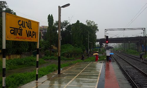
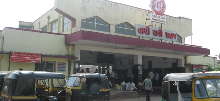
Vapi  is a city and municipality in Valsad District in the state of Gujarat. It is situated near the banks of the Damanganga River and is the largest city in the Valsad district and also the largest city after Surat in South Gujarat.It can be called the most developed city in Gujarat followed by Ahemdabad, Surat, Vadodara and Rajkot.

Around 28 km south of the district headquarters in the city of Valsad, it is surrounded by the Union Territories of Daman to the west and Dadra and Nagar Haveli to the east. Economic and industrial growth in recent decades has blurred the physical boundaries, and a small stretch of roughly 21 km of Daman-Vapi-Silvassa has almost become a single urban area. The town originally belonged to the community of Koli Patel (Local Farmers),Desai (Anavil Bramhins), Jains and other tribal castes later migrated to the city. Known as the City of Chemicals, it is the largest industrial area in Asia in terms of small-scale industries, dominated by the chemical industry. It has been ranked 2 in the year 2008 among the most polluted places in the world, mainly due to its poor air and water quality caused by nearby industrial sites. People who have been living in the town have a lot of complaints about their health due to the pollution emissions happening almost every night from chemical factories.

  • Country – India
  • State –    Gujarat
  • District – Valsad
  • Elevation  –  27.33 m (89.67 ft)
  • Population (2011) – 163,630
  • Official Languages –  Gujarati, Hindi
  • PIN  –   396191 / 396194 / 396195

Photos

Related Posts

  • Mehsana – City

  • Amreli – City

  • Gondal – City

Search

Generic selectors
Exact matches only
Search in title
Search in content
Search in posts
Search in pages
Filter by Categories
About Gujarat
Attractions
Beaches
City
Districts
Famous Peoples
Festivals
Geography
Hill stations
History
Kankaria Karnival
Kite Festival
Lake
Mines
Mountains
Museums
National Park
Navratri
Polo Forest
Ports
Ranotav
Religious Places
Rivers
Sanctuaries
Taluka
Tarnetar
Tourism Events
Zoo

Major Topics

  • About Gujarat36
    • Famous Peoples19
    • Festivals15
    • History1
  • Attractions138
    • Beaches16
    • Hill stations4
    • Lake13
    • Museums25
    • National Park4
    • Religious Places54
    • Sanctuaries15
    • Zoo7
  • Geography394
    • City32
    • Districts33
    • Mines2
    • Mountains13
    • Ports12
    • Rivers53
    • Taluka249
  • Tourism Events6
    • Kankaria Karnival1
    • Kite Festival1
    • Navratri1
    • Polo Forest1
    • Ranotav1
    • Tarnetar1

New Updates

  • History
  • Rann Utsav
  • Polo Forest
  • Mehsana – City
  • Amreli – City
  • Gondal – City
  • Tarnetar
  • kalol (gandhinagar) – City
  • Valsad – City
  • Jetpur

Popular Posts

  • Aji River January 11, 2017
  • Auranga River January 11, 2017
  • Banas River January 11, 2017
  • Bhadar River January 11, 2017

Beaches

  • Chakratirth Beach, Diu
  • Jallandhar Beach, Diu
  • Ghogla Beach, Diu

Popular Searches

About Gujarat Attractions Beaches City Districts Famous Peoples Festivals Geography Hill stations History Kankaria Karnival Kite Festival Lake Mines Mountains Museums National Park Navratri Polo Forest Ports Ranotav Religious Places Rivers Sanctuaries Taluka Tarnetar Tourism Events Zoo

Follow Us

Important Links

Contact us
Website Disclimer
Terms & Conditions
Copyright @ Infy World | Proudly Powerd By Dotsinnovations